The Lowther : Brougham to Shap
On this page we explore the valley of the River Lowther, following its course upstream to its source near the village of Shap. We begin at Brougham Castle near Penrith, where the Lowther flows east into the Eamont and then continue up its valley, heading southward.

Our journey includes the beautiful Lowther Castle, to the east of the river and the lovely village of Askham, on the river’s western side. We head south west via the village of Bampton into the adjoining valley of Mardale to reach the quiet serenity of Haweswater, an ancient glacial lake that is part of the Lowther’s catchment and now a long-established reservoir for the North West.
The Lowther lies entirely within what was the historic county of Westmorland and our journey upstream along its course is completed near the Westmorland village of Shap, not far from where the river begins at ‘Wet’ Sleddale in the Shap Fells.

Along its course, much of the valley of the Lowther is followed to the east by the A6 and M6. Beyond the M6 motorway are the valleys of the rivers Leith, Lyvennet and Eden, which along with the Lowther collectively form part of the broad vale of the Eden, with the Lakeland Fells to its west and Pennines to its east.
Brougham Castle
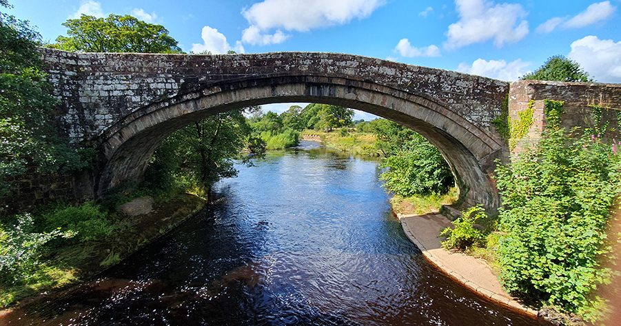
The A66 lies a little beyond the southern edge of Penrith, with the River Eamont and River Lowther to its south. Just off the A66, a road is signposted for Brougham Castle and on reaching the castle you are struck by the beauty of its riverside setting with a stone bridge crossing the River Eamont and the River Lowther entering the Eamont just to the west.

Overlooked by the castle, the road across this stone bridge was once part of the old ‘London Road’ from Penrith but is now detached by the A66. East of the bridge, the busy A66 crosses the Eamont by a bridge of more recent times. The ‘Old London Road’ from Penrith, followed a Roman road that is still partly followed by the A66 as it heads onward through the Eden valley via Appleby and Brough. It crosses the Pennines through the Stainmore Gap, heading towards the old A1 at Scotch Corner on its way to London and the south.

It is beneath Brougham Castle, a little before the old bridge, that the River Eamont is joined by the Lowther, with the castle sited to the south of both rivers overlooking the point at which they meet.

Brougham Castle was built on the site of an earlier Roman fort called Brocavum and stones from this fort were used in its construction. The name ‘Brougham’ was recorded as ‘Bruham’ in 1228 and refers to a ‘ham’ or settlement near a ‘burg’ meaning ‘fort’ and is likely a reference to the Roman fort of Brocavum.
Brougham Castle is built on the northern part of the earlier fort. On the castle’s south side, the remaining visible earthworks still reveal the typical ‘playing card’ outline of a Roman fort.

Historically, this area is not is not just a meeting point for rivers as Roman roads meet here too. From the south east is the Roman road from York arriving from the Stainmore Gap. Its journey through the Eden valley brings it here via Roman forts at Brough (Verterae) and Kirkby Thore (Bravoniacum). Other forts connected to Brocavum included Voreda at ‘Old Penrith’, to the north between Penrith and Carlisle, on a Roman road heading for Hadrian’s Wall.
Directly south of Brougham, another Roman road arrived from Manchester (Mamucium). It now partly follows the course of the London to Carlisle railway. A third Roman road arrived at Brougham from the Roman naval base at Ravenglass (Glannoventa) on the Cumberland coast. This road follows a course passing through Roman forts at Hardknott and Ambleside (Galava) before following the Roman mountain road known today as ‘High Street’ heading through the high fells between Ullswater and Haweswater.

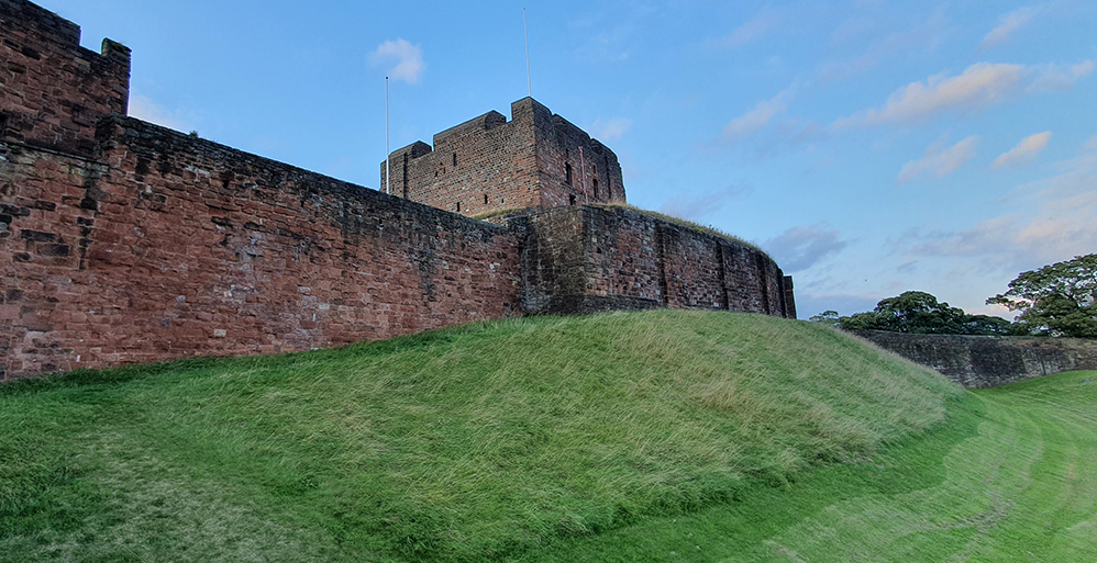
Built from local red sandstone on the site of the Roman fort, Brougham Castle (pronounced ‘Broo-um’) has a beautiful setting above the meeting of the Eamont and Lowther and its ruins are more extensive than those of Penrith Castle.
The castle’s origins date to the early thirteenth century, from around 1214, occupying a strategic position on high ground close to the junction of the two rivers and near the meeting of roads. The family associated with the castle’s foundation were the de Vieuxponts, sometimes called Viteripont or Vipont. They were granted Appleby, Brough and the Barony of Westmorland around 1203.
One of the family was a powerful baron called Robert de Vieuxpont, who founded the castle. He was a loyal supporter of King John at a time when many barons were enemies of the king. His grandson, another Robert, rebelled against another powerful baron called Simon de Montfort in the 1260s and the castle was briefly confiscated from the family by Henry III.

Although it is around thirty miles from the present Scottish border, Brougham Castle was situated at the heart of disputed territory within the border region. Historically, the River Eamont seems to have marked the border of the Kingdom of Strathclyde and at the time of the Norman Conquest it formed part of the Scottish border. Penrith and Carlisle were then situated within the Scottish kingdom.

In 1092, King William Rufus invaded the area north of the river and it was settled by his followers. In 1135 the area was retaken by the Scots under David I. By 1141 the Scots were even making claims to the neighbouring Honour of Lancaster as far south as the River Ribble. In 1157 Cumberland was retaken by King Henry II of England who granted the land to Gospatric, the son of Orm. Despite this, the region was still very much a border zone, particularly during the continuous early wars between England and Scotland (1296-1357), when Brougham served as an important military base.

By this time Brougham Castle had passed from the Vieuxponts to the de Cliffords who inherited the castle in 1269 after Roger Clifford married Isabel Vieuxpont, inheriting Brougham, Appleby and Westmorland. Around 1296-1300, Roger and Isabel’s son, Robert de Clifford, began the extensive refortification and expansion of Brougham Castle including its stone gatehouse and ‘Tower of League’. The castle had previously consisted of a Norman stone keep surrounded by an outer wooden permitter or palisade.

In 1300, Brougham Castle was visited by King Edward I, known as ‘the Hammer of the Scots’, during his military campaigns. Further development of the castle seems to have been undertaken in 1309 when King Edward II granted a ‘licence to crenellate’. In 1310 Robert Clifford was also granted Skipton Castle in Yorkshire by Edward II. Skipton would become one of the family’s principal residences.

In 1307, King Edward I had died at Burgh by Sands near Carlisle after taking ill during his military campaign against Robert the Bruce. His successor, Edward II, proved to a weak king and was notably defeated by the Scots under Bruce at the Battle of Bannockburn in 1314. The battle, fought near Stirling in Scotland, saw the death of Robert Clifford of Brougham Castle.

These were troubled and rebellious times. In 1322 Robert Clifford’s son, Roger Clifford, was executed for his role in leading a rebel army against the king’s forces at the Battle of Boroughbridge near Ripon in Yorkshire. Clifford’s place of execution, the keep at York Castle, would come to be known as ‘Clifford’s Tower’.
Brougham Castle was briefly granted to the victorious leader of the king’s forces at Boroughbridge, a Westmorland man named Andrew Harclay or De Harcla, who became Earl of Carlisle. The Harcla family were connected to Harcla (Hartley) Castle near Kirkby Stephen.
With the continuing Scottish wars and defeat of the English at the Battle of Old Byland in Yorkshire, on October 14, 1322, Harclay became disillusioned with King Edward. He signed a peace treaty with Robert the Bruce of Scotland at Loch Maben in Dumfriesshire, without the king’s permission and in March 1323 he paid the price. Harclay was arrested and executed at Carlisle for treason.

In 1327 Edward III became the king of England and the Cliffords found themselves back in favour. By 1333 the Clifford estates were returned to Robert, the brother of Roger Clifford, who had died in 1322. It was in 1333 that Edward Balliol, the English-backed claimant to the Scottish throne sought refuge with the Cliffords at Brougham Castle. Balliol, who had been expelled from Scotland, had been installed as a ‘puppet’ king of Scotland by Edward III.

Although the Treaty of Berwick in 1357 brought peace between England and Scotland, the cross border rivalries still festered. In 1388 Brougham was sacked and captured by the Scots in a two pronged attack on England, east and west of the Pennines that ultimately saw the English Percy family engage with the Scottish Douglas family at the Battle of Otterburn in Northumberland.
In 1461 Brougham Castle was granted to the Neville family after John Clifford was killed in battle fighting against King Henry VI in the Wars of the Roses. At this time the Nevilles and Cliffords were fierce rivals. John’s son, Henry Clifford would later reclaim the castle with the approval of the Tudor king, Henry VII.

In 1525, the title ‘Earl of Cumberland’ was created by the second Tudor king, Henry VIII for the Clifford family with the first holder of this title being Henry Clifford. He was the Warden of the Western March, responsible for defence and border control from 1534 to 1542. Despite the family’s Catholicism, Clifford refused to support the Catholic Pilgrimage of Grace rebellion against Henry VIII. Henry Clifford’s son and successor, Henry, the second Earl of Cumberland, similarly refused to support the Rising of the North rebellion against Elizabeth I in 1569.

By the end of the sixteenth century Brougham Castle was out of favour with the Clifford family and had fallen into disrepair. Fortunately, Margaret, the widow of the third Earl of Cumberland (who had died in 1605) and her famed daughter, Lady Anne Clifford retained the property when other Clifford properties passed to Francis Clifford, the fourth earl and later his son, Henry, the fifth Earl. When Henry died in 1643, without a male heir, the extensive family properties passed to Lady Anne.

Lady Anne Clifford undertook extensive restoration at Brougham Castle and likewise undertook work at her castles of Appleby, Brough and Skipton. A highly influential figure in the north and a patron of the arts, she is still fondly remembered in Westmorland. A modern sculpture of her can be seen in the town of Kirkby Stephen.

During the English Civil War of the 1640s Brougham Castle served as a Royalist garrison under the leadership of Sir John Lowther but the castle fell to the Parliamentarians under Colonel John Lambert. After the war the castle remained a Clifford property until Lady Anne’s death in 1676, at Brougham Castle. The castle then passed to the Tuftons, Earls of Thanet, for whom it held little interest. In subsequent years it fell into disrepair and ruin.
In later years, the castle captured the imagination of the Lakeland poet, William Wordsworth who explored the ruins and mentioned them in The Prelude of 1798. Wordsworth also featured the castle in his Song at the Feast of Brougham Castle in 1807. In 1825 the famed artist J.M.W Turner painted a watercolour of Brougham Castle.
In 1849 the castle passed from the Earls of Thanet to their descendants, the Hothfields, but its future protection was not assured until it was acquired by the state in 1927. Today the castle is an English Heritage property.

As well as Brougham Castle there are a number of other notable historic sites in and around the Eamont, near the castle. One of these is St Ninian’s church, known locally as ‘Ninekirks’ on the south side of the Eamont at an isolated location a mile and a half east of Brougham Castle. Here the Eamont is making its way towards the Eden and nearby is the site of the former RAF Hornby.
St Ninian’s church was rebuilt on the site of the earlier Brougham parish church and is also said to be on the site of a foundation established by St Ninian himself. It was possibly a monastery. Ninian was a Pictish saint who died around AD 432. He was associated with establishing an early church at Whithorn in Galloway, on the northern shore of the Solway Firth.
Over on the other side of the River Eamont not far from the ‘Ninekirks’ church are formations called the ‘Giant’s Cave’ where a man-eating giant called Isir is said to have resided. Legend connects this cave with a giant called Tarquin who was slain by Sir Lancelot, according to an Arthurian tale.
At little closer to Brougham, near the A66, a quarter of a mile east of the castle, is the Countess Pillar. In 1656 Anne Clifford erected this fourteen feet high monument. It commemorates a visit by Anne to see her mother at Brougham Castle in the early part of 1616, when Anne was making inspections of the Clifford estates. The two women would say farewell at this point to the east of the castle. It would be the last time Anne saw her mother, who died a month later.

Brougham Hall
Rather than crossing the old bridge at Brougham Castle and heading back to the busy A66 we stay on the south side of the Eamont and Lowther and head along the road that takes us west along the valley of the Lowther. Heading slightly south west, within three-quarters of a mile we reach the historic castle-like Brougham Hall that must not be confused with Brougham Castle itself.

Brougham Hall is an impressive medieval hall, about half a mile south west of Brougham Castle and is situated close to the south bank of the River Lowther, near the village of Eamont Bridge. The hall has free admission but donations are suggested.

There has been a hall of some kind here since 1307 but the oldest part of the present hall is Tudor and it is somewhat surprising that Brougham Hall is not better known. Today, Brougham Hall includes attached shops, a pottery and a cafe.

One of the first striking features we notice is a replica of Durham Cathedral’s sanctuary knocker that features on the Brougham Castle doorway. It is one of four replicas created in 1927.

Historically, Brougham belonged to the de Burgham (or de Brougham) family whose ancestors are said to have held the site from before the Norman Conquest. They became military retainers for the Vieuxponts of Brougham Castle.

Later, part of Brougham Hall was under the ownership of Lady Anne Clifford and subsequently passed to her steward, James Bird and his descendants.

It was Lady Anne who built St Wilfrid’s Chapel, that can still be seen to the north of the hall alongside the River Lowther. The hall returned to a separate branch of the Brougham family in the 1720s.
West of Brougham Hall is Penrith Show Ground and a bridge across the River Lowther near the southern end of Eamont Bridge village. Close by are two prehistoric earthworks between the M6 and A6, called Mayburgh Henge and King Arthur’s Round Table.

A road adjoining the A6 south of Eamont Bridge village heads over the M6 and then along the Lowther valley to Lowther Holiday Park on the west side of the motorway. For now, we stay east of the Lowther valley and the motorway and instead head south along the A6. The A6 is the historic ‘Carlisle to London’ trunk road, which historically terminated at Luton in Bedfordshire.
Clifton
A mile along the A6 south of Eamont Bridge on the west side of the M6 from Lowther Holiday Park we reach the village of Clifton. Its name means ‘settlement on a hill’ rather than cliff in the modern sense of the word. The village sign proudly features the claim ‘Last Battlefield on English soil 1745’. At the north end of the village is Clifton Hall and across the road, is the part-Norman church of St Cuthbert. The hall, an English Heritage property, is a medieval fortified pele tower. From around the 12th century Clifton was held by the Engaine family and later by their descendants, the Wyberghs. It is not clear which family built the tower.
The River Lowther is only a quarter of mile west of Clifton but the village is now somewhat detached from its valley by the neighbouring M6. Clifton village itself is also split in two by a bridge that takes the main street across the West Coast Main Line Railway,

The ‘battle’ at Clifton took place on December 18th, 1745 during the Jacobite Rebellion (see Penrith). A Scottish army under Charles Stuart ‘Bonnie Prince Charlie’ invaded England in November 1745 seizing Brampton and Carlisle. Heading south into Lancashire, the Jacobites occupied Preston and Manchester. Although a regiment of Jacobites was recruited at Manchester, significant support from English Jacobites did not materialise. Reaching Derby on December 4th, the Jacobites decided to retreat, turning back home on December 6th. They were pursued by the British army under the Duke of Cumberland, a younger son of George II.
At Clifton, the Jacobite rearguard engaged in a skirmish with the Dragoons of Cumberland’s army. The inconclusive engagement was a tactical delay by the Scots enabling the main body of their army to escape north. The Scots involved in the battle were the Glengarry clans of McDonnell and McDonald who attacked from the western flank and McPherson clansmen under Charles McPherson and General George Murray, attacking from the east. Eleven clansmen were killed. According to a local woman of the time, they were buried near ‘the Rebel Tree’ that can still be seen on a small green in Clifton’s Jacobite Gardens, behind the George and Dragon pub.
Lowther Castle
South of Clifton, the A6 passes beneath the M6 and heads alongside modern bungalows on its west side that are part of a small housing estate adjoining Lowther village. Near the end of this row we enter Hackthorpe village. Its name means ‘farm or village of Haki’, from an Old Norse personal name. Alongside the A6 at the village centre is an inn called Lowther Castle and at the south end is the Jacobean Hackthorpe Hall, now a business centre, but once a Lowther family residence. From here the A6 crosses the M6 again and continues south to Shap, although an adjoining road heads east to Great Strickland, the River Leith and Morland in the Lyvennet valley.

To the west of Hackthorpe we find the impressive Lowther Castle set in a 3,000 acre parkland along with two historic villages called Lowther, neither of which is the original Lowther village. Lowther Castle and the earlier Lowther Hall, which the castle replaced, was home to the Lowther family.
The first family member, who is said to have founded Lowther village as a family seat, was Dolfin de Lowther, thought to be a noble with Anglo-Viking and Scottish roots. His father was Gospatric I, the Earl of Northumbria. Before 1092 Dolfin had been known as Dolfin of Carlisle. Through his son, Hamon de Lowther, family descendants feature a long and illustrious line of Lowthers that included a Richard Lowther who brought Mary Queen of Scots, under guard, here to Lowther on her way to imprisonment at Bolton Castle in Wensleydale, on the orders of her cousin, Elizabeth I.
Later Lowther family members included Sir John Lowther (1605-1675), the Governor of Brougham Castle in the Civil War and his grandson, Sir John Lowther, the First Viscount Lonsdale, later the First Lord of the Treasury, who was born at Hackthorpe Hall. Around 1683, the first viscount removed the original Lowther village near Lowther church and built a new village called ‘New Town’ that still exists today to the east of the castle. In 1686 the viscount then replaced an earlier hall with a new Lowther Hall that would itself be replaced by Lowther Castle in the early nineteenth century.

The first viscount was succeeded by two sons, the second and third viscount and in 1720, during the time of Henry, the third viscount, Lowther Hall suffered a serious fire. Henry, unmarried, left no heirs and the estate passed to his great nephew, James Lowther (1736-1802). A son of Robert Lowther of Maulds Meaburn, James became the first Earl of Lonsdale and was nicknamed ‘Wicked Jimmy’. An owner of a slave planation in Barbados, he inherited other estates belonging to other Lowther family branches at Marske on the Cleveland coast of Yorkshire and at Whitehaven on the Cumberland coast, where coal mining became an important source of his wealth.
Lowther was noted for his numerous mistresses and his political manoeuvrings. He purchased political favour with his wealth, often switching between the Tories and the Whigs. Through local influence he secured the election of William Pitt ‘the Younger’ into parliament for the first time. Pitt became MP for Appleby, a ‘Pocket Borough’ that was in the control (the pocket) of Lowther. Pitt, who became Prime Minister in 1783, would later campaign against Pocket Boroughs. Lowther’s political influence extended to elections in Cumberland, Westmorland, Carlisle and Cockermouth. He had an unscrupulous reputation and notably refused to pay outstanding debts to numerous creditors including his own lawyer, John Wordsworth, the father of the famed poet, William Wordsworth.
It was during James’ time, in 1767, that plans were draw up by the architect Robert Adam for a grand new house at Lowther, but this came to nothing. However, it is thought Adam contributed to the building of a second new village of Lowther in 1765-1773. Like the earlier ‘New Town’, this village still exists and is situated towards an estate of more recent houses and bungalows near the A6. It is interesting to compare the layout and building style features of the two planned villages.
On his death in 1802, ‘Wicked Jimmy’ was succeeded by his cousin, William Lowther (1757-1844), also titled First Earl Lonsdale. He paid the debt to John Wordsworth and became a patron of John’s talented poet son, William Wordsworth. It was in the period 1806-1811 that the architect Robert Smirke, in his first major work, built the magnificent Lowther Castle for the Earl, incorporating part of the earlier hall. William Wordsworth himself stayed at Lowther Castle and compared it to a cathedral:
Lowther! in thy majestic Pile are seen
Cathedral pomp and grace, in apt accord
With the baronial castle’s sterner mien.

William Lowther’s son and successor, William (1787-1872) the Second Earl Lonsdale was remembered as a collector of Etruscan, Egyptian and other exotic eastern art. More notoriously, he was noted for having no official heirs despite fathering at least four illegitimate children to four separate French women, including a Parisian dancer; an opera singer and a ballerina. On his death, the estate passed to Henry, grandson of the First Earl and then Henry’s son, St George Lowther, the fourth Earl (born 1855), a racehorse owner. St George’s wife Gladys, kept colourful company. She was a friend of King Edward VII’s famed mistress Lily Langtry, who stayed at Lowther Castle as a guest of Gladys.
St George was succeeded by his brother, the indulgent and quite literally ‘colourful’ Hugh Cecil, 5th Earl of Lonsdale. He was known as the ‘Yellow Earl’ from his yellow tailored suits; yellow carriages and yellow gardenia flowers in his button holes; he even owned a yellow Rolls Royce. As well as having a dalliance with Lily Langtry, the earl was noted for his influential company that included his friend Kaiser Wilhelm II, who came to stay at Lowther Castle on two separate occasions to shoot grouse. The Kaiser later bestowed a Prussian knighthood on the earl. Other guests of the earl at Lowther Castle included the King of Portugal and the King of Italy.

Hugh Cecil, the ‘Yellow Earl’ stood at over six feet tall and was a multi-talented sportsman of note. He had an interest in horse racing, being a Steward of the Jockey Club as well as being a highly successful award-winning yachtsman and a restless explorer whose adventures took him to Alaska and Arctic Canada. The earl was also remembered for his legacy to boxing. As an accomplished boxer, he once knocked out the reigning World Champion John L. Sullivan at a match held in New York. The earl had a huge impact on the sport in Britain, being the President of the National Sporting Club and introducing boxing’s famous Lonsdale Belt in 1909. He was also Honorary President of Arsenal Football Club and the first ever President of the Automobile Association or AA as it is known today.
The earl’s wealth was drawn from his family estates and particularly the revenue from mining interests in west Cumberland, where family possessions included Whitehaven Castle. Unfortunately, while the earl provided so much colour to the story of Lowther Castle, his extravagant and indulgent lifestyle proved to be catastrophe for its very fabric.

In 1924, as the earl’s debts mounted, Whitehaven Castle was sold to an industrialist, but Lowther Castle remained a Lowther-owned property. In 1936, proving too costly to maintain, the castle was abandoned and left to ruin, although it was briefly acquired in the Second World War as a training ground for tanks. In 1944, the Earl, whose wife had been unable to bear children, died childless. His brother and successor, Lancelot, the 6th Earl, was left to face the debts. Lancelot sold off the possessions of the house with everything from chimney pots to door handles put up for sale. Under his grandson, James Lowther (1922-2006), the seventh Earl, the castle roof was removed, reducing the whole building to a shell.
James, an engineer, focused on farming at Lowther but the future of the castle remained uncertain. Finally, in 2000 English Heritage came together with the Lowther Castle Estate to develop a conservation plan, reinforced later by the establishment of the Lowther Castle and Gardens Trust in 2007. There had been gardens here since the seventeenth century but these had also fallen to ruin. Today, the grounds feature a rock garden, a sweet-scented garden and an Iris garden as well as a ‘lost castle’ adventure playground.

Just north of the castle, towering above the Lowther valley is Lowther’s church of St Michael. Inside, it is medieval, dating back to the Norman era, although the tower is of 1856 and other parts of the exterior date from 1686. It is likely the Norman church is on the site of an earlier one as preserved inside are a group of intriguing sculptured tomb-like Viking ‘hogback’ stones that are often found at church sites throughout Cumbria and North Yorkshire. Other notable hogbacks can be found at Brompton near Northallerton; the so-called ‘Giant’s Grave‘ in Penrith churchyard, as well as some impressive collected examples that can be seen at the museum of Durham Cathedral. Perhaps the Lowther hogbacks were connected with the Anglo-Danish forebears of Dolfin de Lowther.
In the churchyard of St Michael above the valley of the Lowther is the Lowther Mausoleum of 1857 commemorating William Lowther, first Earl of Lonsdale who died in 1844. We should note here that the Earls of Lonsdale are through their surname, a family firmly connected with the River Lowther and its valley but their actual title ‘Lonsdale’ derives from the valley of the River Lune (a river name meaning ‘healthy’ or ‘health-giving’) that flows through Westmorland and Lancashire further to the south. The Lune gives its name to the Westmorland town of Kirkby Lonsdale and also the county town of Lancaster (Lune-Caster, the fort on the Lune) from which Lancashire is ultimately named.

As for the river-name Lowther, it is first recorded as ‘Lauther’ around 1160 and may be Brittonic, with a similar root to the Scottish place-name Lauder, a place on the Leader Water in Lauderdale near Melrose. It is thought to be related to an old word for ‘bath’ that also likely gave rise to the name of Lavatrae, a Roman fort at Bowes in Teesdale at the eastern end of the Stainmore Pass. Alternatively Lowther could be from the Old Norse ‘lauðr’ meaning ‘froth’. In fact this could be a Viking interpretation of an earlier name.

Askham
Down in the valley of the River Lowther, below Lowther’s church of St Michael, a stone bridge crosses the river and on the immediate west side of the crossing we reach the pretty village of Askham. In early times a ford crossed the river between Lowther Hall and Askham up until 1685 when it was superseded by a narrow bridge that was in turn replaced by this slightly wider bridge of 1897.
Askham’s name derives from either the Anglo-Saxon ‘aescum’ or the Old Norse ‘askum’ both of which mean ‘ash trees’ – the ‘um’ element of such names indicates a plural. This is combined with a word ‘aesc’ or ‘ask’ meaning ‘ash tree’. In the thirteenth century the manor of Askham belonged to the Helbeck family and then later the Swinburns (or Swynburns). From 1375, the Sandford family held the village for three and a half centuries up until 1724, when it passed to the Tathams and then later the Lowthers.
The first thing we encounter in Askham, after crossing the Lowther is Askham’s parish church of St Peter on the south side of the road. It was built in 1832 by Robert Smirke, who had built Lowther Castle two decades earlier. Smirke’s church is built in Norman style with Norman arches. It replaced the earlier medieval parish church.

From the bridge, we follow the road that forms Askham’s main street, climbing up from the river with the entrance gateway to Askham Hall on the north side of the street. Now a hotel, the hall with its battlemented exterior, developed around a fourteenth century pele tower that defended against Scottish raids. The battlemented tower forms the core of the building. Features within include an impressive fireplace and a seventeenth century staircase.
The pele tower was developed as an Elizabethan manor house centred around a courtyard and built by Thomas Sandford in 1575. After passing to the Tathams and their successors from 1730, the hall was sold to William Lowther, first Earl of Lonsdale, in 1815. After Lowther Castle was abandoned in 1936 it became the local residence for the Earls of Lonsdale. Under the Countess of Lonsdale, the property was converted into a luxury boutique hotel in 2012.

Passing the hall’s entrance gateway on the main street we enter the village itself with its undulating village green. On the left at this eastern end of the village is an inn called the Punch Bowl. Still following the rising main street as it cuts through the centre of the village green we reach the village centre where we find the Queens Head inn and the local village store. Sign posts in the village centre give directions and distances to Yanwath (2 ½) miles; Penrith (5 miles); Helton 1 mile and Haweswater 6 miles.
Beyond the village centre, the street continues through the green leaving the village behind to follow a trackway onto the lower reaches of Askham Fell. Along with Heughscar, Askham Fell separates the Askham and Lowther area from lake of Ullswater that lies beyond to the west.
Askham Fell is home to the ancient Cockpit Stone Circle with the course of the remote Roman road called High Street passing nearby. From the village centre another road north west from Askham skirts the higher ground around the north edge of Askham Fell and makes its way to Pooley Bridge on the River Eamont at the northern end of Ullswater. A road south from Askham centre splits into a fork just beyond the village from where we can head to the village of Whale, to the east of the Lowther, or to the village of Helton to its west.

Whale is the smaller of the two villages and takes its name from an Old Norse word ‘hvall’ meaning ’round hill’. Whale is slightly to the south east, across the Lowther from Helton. Somewhat further to the south of Whale, on the east side of the river, is a farm called Knipe and nearby is Knipe Hall, a seventeenth century house.
To the west of the River Lowther the little village of Helton has an undulating setting where the land begins to rise towards Askham Fell. To the south west, a quiet road from Helton leads onto the lower reaches of the fell. Further south is a tiny village called Butterwick on a River Lowther tributary called the Gill Beck and to its south are the larger twin villages of Bampton and Bampton Grange, on the respective west and east side of the Lowther. They are linked by a bridge of red stone. Bampton Grange, east of the bridge is home to the Georgian church of St Patrick, dating to 1726.
Bampton (not to be confused with Brampton near Carlisle) is a quarter of a mile downstream from the bridge and set away from the western bank of the Lowther. Situated on the Howes Beck, it is the home to the Mardale Inn on the south side of the stream. This community owned pub is also known as ‘The Bampton Jerry at ‘St Patrick’s Well’. Bampton was a birthplace for two bishops. One was Hugh Curwen, Bishop of Dublin and Lord Chancellor of Ireland (1555-1567) and later a Bishop of Oxford 1567 until his death in 1568. He is perhaps recalled in the nearby Ireland Wood and Hugh’s Mire. Historically, the Curwens resided at Thornwaite Hall, a former pele tower to the south of Bampton near Haweswater Beck. The other Bampton-born bishop was Edmund Gibson, a Bishop of Lincoln, 1716-1720 and later Bishop of London 1723-1748.
Haweswater
Roads south from Bampton head upstream along the Lowther tributary called Haweswater Beck taking us to Haweswater Reservoir in the glacial valley of Mardale. Recorded as ‘Haverswater’ in 1199, Hawewater may mean ‘lake belonging to Hafr’, a Viking personal name. Haweswater is one of the major natural lakes of the Lake District but the shoreline of today is a result of the lake’s conversion into a reservoir in 1929-1935 by Manchester Corporation, following parliamentary approval in 1929. Haweswater provides drinking water for that city and its neighbouring populous towns, supplying 25% of the North West region’s water.
The banana-shaped Haweswater Reservoir curves south to north east with both its north and south ends extending further than the original lake. Water levels rose 95 feet when the dam was created and the length and breadth of the lake also increased. The creation of the reservoir necessitated the pre-planned removal of two communities along the lake’s shoreline. The reservoir’s dam, built by Manchester Corporation in 1929-1935, is at the north end.

Towards the lake’s north end, on the western shore, a little hamlet called Measandbecks, near a now submerged peninsula, was lost. It was the site of a school dating from 1713, that was dismantled before the reservoir was built and rebuilt at Walmgate Head at Bampton. Also submerged was the site of the village of Mardale Green, beyond the south end of the lake. This village included the church of Holy Trinity (its stones were used in building the dam). Graves from the churchyard were removed prior to the flooding and relocated to Bampton Grange.
Mardale Green’s village pub called the Dun Bull Inn was another building demolished to make way for the reservoir. Its furnishings were moved to a new pub at Bampton. When water levels in the reservoir are low, the roads, tracks and outlines of lost buildings are sometimes revealed along with the hump-backed ‘Chapel Bridge’ that crossed the now submerged part of the Mardale Beck.
The present road along Haweswater’s eastern or southern shore was specially built for the reservoir. Originally, the main road along the lake shore was on the northern or western side but this was lost to the reservoir. Alongside the new road is the impressive stone-built Art-Deco themed Haweswater Hotel of 1937, half way along the east shore. Its appeal lies in the quiet remoteness of its location.
Upstream from Haweswater’s south end is Mardale Beck and to its west are little lakes called Small Water and Blea Water, situated between Harter Fell and the famed fell called High Street near the lake’s south end. The High Street fell is named from the Roman road of ‘High Street’ that crosses its summit, skirting the nearby Kidsty Pike or fell. Further west still is Hartsop village and a lake called Brothers Water, on the Kirkstone Pass linking Ullswater to Windermere.
Leaving Haweswater behind we now head back to Bampton and follow a road down the west side of the River Lowther. To the south, shortly before the Lowther is joined by the Swindale Beck, the road crosses the Lowther by a little bridge and heads into the village of Rosgill near which roads leave the course of the river. From Rosgill the road heads south west towards the village of Shap on the A6. In a more remote location, west of Shap village, is the historic Shap Abbey, situated alongside the western bank of the River Lowther.

Shap
Shap Abbey was founded around 1200 on a site granted by a local landowner called Thomas, the son of Gospatric. The recipients were Premontratensian Canons (or ‘white canons’) headed by an abbot. They had previously been based at a site alongside the Peasey Beck about four miles south of Kendal, near Preston Patrick.

Shap Abbey was a small establishment consisting of twelve canons but was relatively wealthy, with lands bestowed upon it by the powerful Vieuxpont and Clifford families. One of the Shap abbots, a Richard Rodman, who died in 1505, became the head of the Premonstratensian order in England. The monastery was closed in 1540 as a result of Henry VIII’s religious reforms and today its main surviving feature is the western tower.
On the banks of the Lowther, about half a mile south of Shap Abbey we find a pretty little village called Keld. It is the home to a sixteenth century chapel that is now in the care of the National Trust. The chapel was once the chantry for Shap Abbey. Like the village of Keld in Yorkshire’s Swaledale, this Westmorland village has a Viking name that derives from ‘Kelda’ meaning ‘spring’ or ‘well’. Shap Abbey and Keld are a just under a mile west of the village of Shap itself, that is situated along two sides of the A6.

Shap and its abbey were historically called ‘Heppe’, a name that was still an alternative name for the abbey until at least the eighteenth century. In the thirteenth and fourteenth century early spellings include ‘Yhep’, ‘Heppe’ and ‘Sheppe’. The name derives from an Anglo-Saxon word for a ‘heap’ of stones that was transformed under Norse influence to ‘hiap’ and subsequently became ‘Shap’.

The ‘heap of stones’ is a rather intriguing feature of Shap as it most likely describes the prehistoric ‘Shap Stone Avenue’, most of which has been lost or destroyed. This avenue of stones was one of the greatest Megalithic complexes in Britain. Even in the eighteenth century, when antiquarians were deeply impressed and fascinated by this site, much of it had already been lost in the development of Shap village. Further destruction came in the Victorian railway age when what is now the West Coast Main Line was constructed.

Shap’s prehistoric avenue included at least two stone circles with one at its centre but the avenue itself primarily consisted of two rows of stones stretching for about a mile and a half. At the south end of the avenue was a stone circle known as Kemp Howe which is now mostly lost. It is about 600 metres beyond the south end of Shap village with only six stones remaining alongside a railway embankment that can just be seen from the A6. The railway itself ploughed straight through the circle, destroying it forever.
In Shap itself the lovely stone-built Greyhound Inn (dated ‘1703’) is thought to stand on the site of the central stone circle known as ‘Carl Lofts’. The stone avenue veers north west from the village here and although nearly all of its stones were removed and repurposed over the centuries and decades, some features can still be seen in the countryside to the west of Shap village. They include the 10 feet high ‘Goggleby Stone’ and to its north the Skellaw Hill Barrow, a burial cairn. Towards the north west end of the avenue is the eight feet high Thunder Stone in a field about half a mile slightly north west of Shap Abbey.

The purpose of Shap Stone Avenue is not known though it is interesting that it occupies an area that was later chosen as the best location for the major transport routes of the A6, M6 and West Coast Main Line. Shap Stone Avenue should be considered in the context of other local prehistoric features like Long Meg and Her Daughters above the Eden Valley; the Mayburgh Henge near Penrith and Casterigg Stone Circle near Keswick. There are also two other relatively modest stone circles near Shap that we can mention. One is the Gunnerkeld Stone Circle alongside the east side of the M6 a mile north of Shap; the other is the Oddendale Stone Circle about half a mile east of Junction 39 of the M6, to the south of Shap.

Shap village itself is a long linear village of stone houses focused along the course of the A6 with some fantastic views looking towards the fells to the west. About half way along the main street on the west side, just north of the Crown Inn is the old market hall of the village with three low arches and probably built around 1690 to serve a market established at Shap in 1687.

Slightly further north on the east side of the main street is Church Street leading to Shap’s church of St Michael. Parts of this church date to around 1200 but there was significant rebuilding in 1838 and the church tower dates to 1894.

Shap’s neighbouring fells are well-known for the quarrying of the famous Shap granite, a distinct granite that is rich in feldspar, mica and quartz and formed from a geological intrusion around 400 million years ago. Quarrying has long taken place at Shap but was developed in earnest from 1875 by the Shap Granite Company.

There are several active and long-since worked quarries around Shap both north and south of the village but the two big quarries that developed in the nineteenth century are to the south. Two main kinds of Shap Granite can be found and are identified by their colour. The two old quarries that we mention were respectively associated with the two coloured forms of Shap granite.

There is a quarry just south of the village and another to the east beyond the M6 but the two historic quarries we note here are further south along the A6 and like so many quarries are subtly hidden from the neighbouring road. One is ‘Blue Rock’ quarry on the west side of the A6 with further development extending to the east. Further south, near Wasdale Beck again on the west side of the A6, is ‘the famous Shap Quarry’ noted for its Pink Granite, from the distinct pink-coloured crystals of feldspar it contains.
Different forms of Shap granite have been used for several purposes. In a highly polished form it has been used as decorative feature in famed buildings such as St Paul’s Cathedral. In crushed form it has been used as an aggregate in building roads and has been used as a material in the construction of docks.

Returning to the River Lowther and following its course upstream south of Keld village we enter a valley to the west of the old blue and pink quarries, called Wet Sleddale. Note this valley is ‘Wet’ and not ‘West’ Sleddale. It is here the River Lowther begins its course, fed by a collection of gills and streams, including Sleddale Beck here on Shap Fell. Part of the valley is occupied by a small reservoir where the Lowther more or less begins its journey northward on its way to its meeting with the River Eamont at Brougham Castle.
To the east of Wet Sleddale, the A6, M6 and West Coast Main Line Railway continue their journey southward through the wild moors of Shap Fell with the M6 motorway reaching its highest point at ‘Shap Summit’ just south of Junction 39 at a height of 1,036 feet. The A6 reaches its highest point about three and a half miles further to the south west at a point that is also referred to as Shap Summit. It is in fact higher than the summit of the M6, at 1,350 feet.
A surprisingly isolated hotel at a location called Shap Wells between the M6 and A6 can be found situated alongside streams called the Birk Beck and Blea Beck. It was built by the Earl of Lonsdale in 1828 after chemical tests suggested the waters here made it a perfect setting for a spa. To its north is the Queen’s monument, a column built by a Mr Mawson of Lowther in honour of Queen Victoria. Topped by the figure of Britannia, its sculpture was the work of Thomas Bland of Reagill, a village to the north east of Shap.

Heading south along the A6 or south east on the M6 we leave the Shap Fells behind but still remain within what was historically the old county of Westmorland. Near Tebay a valley called Bretherdale, a tributary of the River Lune, lies between the two roads, while to the south the two routes are separated by Whin Fell. In the gentler lower lying scenery east of the M6 the village of Orton lies in a valley north of the Lune. It has a thirteenth century church along with both Orton Hall and an Orton Old Hall that are respectively Georgian and Jacobean. East of the village is another stone circle, the Gamelands Circle, which has a nearby car park for its visitors.
To the south, at the M6 Tebay junction we might continue south along the motorway, following the Lune valley as it makes it way to Lancaster or we can head east along the adjoining A685 into the upper parts of Lunedale and onward to Kirkby Stephen in the Eden valley. From there we might head via Brough and the Stainmore Gap across to Teesdale or perhaps south or south east across the hills from Nateby or Mallerstang into Swaledale or Wensleydale.
Alongside the River Lune on the north side of the Tebay junction is a motte and Bailey castle site called Castle Howe, while just south of the junction, the old stone village of Tebay retains its rural charm. About two miles south of Tebay along the Lune and between the river and the motorway is the outline of Borrow Bridge Roman fort.
Further to the west, if we follow the A6 southward we again leave the Shap Fells behind and find ourselves heading towards the historic Westmorland town of Kendal ‘the southern gateway to the Lake District’ that is named from its situation in the valley or ‘dale’ of the River Kent.
Cumberland and Westmorland Pages